
Peter and Donna Thomas' 2006 Route
I. Santa Cruz-San Francisco-Oakland
Day 2 Day 3
Day 4 Day
5
Day 6 Day 7
II. Santa Clara Valley (Day 8 through 10)
III.
Pacheco
Pass
(Day 11 through 20)
IV.
San Joaquin
Valley
(Day 21 and up)
VI. Yosemite
VII. Wawona
VIII. Return to Santa Cruz
April 28 Day 27
Donna's planned schedule had us walking along Merced Falls Road and Highway 132 for most of the day. We were not looking forward to this. Both roads are now more like major highways than the picturesque shaded trails of the 1860s. When we woke up it was already warm and by the time we started walking it was already hot. This sure made us appreciate all the overcast weather we had been complaining about. The old John Muir luck seemed to be with us again because we found a detailed map of the area in a real estate office that showed that we could take a scenic route, perhaps even a short cut, by using horse trails and little roads through the Don Pedro estates.
This was not a subdivision in the jammed packed Alameda or Santa Clara sense of the word. It was a huge area, maybe a whole section of land, with custom homes on three to five acre lots. But, even though there was plenty of space around the houses, and even though there were wildflowers everywhere, it was a disheartening walk. Yesterday, on Fields Road, we had passed through a landscape John Muir would have recognized; rolling hills of oak studded pastureland. Today we walked through land that just a few years before had been the same pastureland but now that landscape was scarred. Oleander and eucalyptus were planted where ceanothus and oaks should have been. Meadows were divided by roads and marred by houses. The roads, rather than following logical contours, cut up and down the hillsides to give more access to more parcels. To a real estate developer or a city planner it was probably a thing of beauty, but to us, always trying to look through John Muir's eyes, it was a catastrophe.
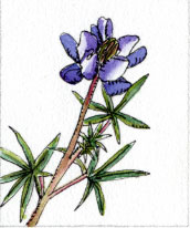
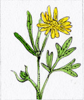
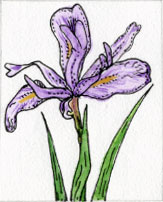
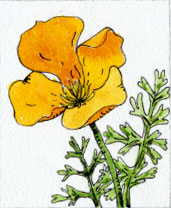
We walked on and on. There were so many wildflowers that I figured some real estate agent must have spread seed just like baking bread in the oven when showing a 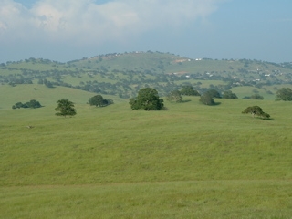 house, and if we could ignore the rape of the hillsides it was a pastoral flowery place to walk. There were yellow fields of fiddleneck, goldfields, frying pan poppies and seep-spring monkey flower, white fields of popcorn flower and bird's eye gilia, as well as owl's clover, mariposa lilies, and all kinds of lupines. But it was impossible to ignore the change. We went up another hill to find those fields of wildflowers surrounding yet more houses, each surrounded by a differently manicured yards. We went down another hill to find the old rock boundary walls crossed by fences, meadows and hillsides being divided into new lots, the old walls broken and without meaning. We began to feel a sorrow, a lamenting: it seemed that nature had already lost the battle and there would never again be a California as beautiful as the one Muir had described.
I guess it was not really Muir luck to find the map. The roads seemed to go on forever, and the trails proved to be only an enticement by the developers. When we came to the spot where the trailhead was marked on the map we could only see a faint track where the trail should have been. We followed it through tall grass for a few hundred yards, but then lost it completely and were left to cut across someone's yard to get back to the road. We did actually meet two women on their horses later in the day. They told us they were probably the only ones who ever used the trials, and hikers would not find any of them passable.
Back on the road, a sedan pulled up next to us, the driver rolled down his window. We could feel the air-conditioning. He said, "How's your trip going? Saw you in the Modesto Bee." We told him a bit about the trip, the days long walk and then asked if he knew of any roads that would cut through to 132 to get us out of there quicker.
"Want a ride?"
We replied "No, that would be cheating."
"Well, I guess I understand, but it's the fricking twenty-first century after all isn't it?"
 So our short cut turned out to be a long cut. We decided that Highway 132 couldn't be any worse, at least it would have a constant and easy grade, so we found our way out of the estates as quickly as we could, put on the lime green Pile drivers Union local 34 vest and started walking along the highway. It was probably the most dangerous length of road we walked the whole trip. 132 is really busy with delivery trucks, boat trailers and commuters who use the road daily to get to work in Modesto or even Livermore. There was usually no shoulder, little space to the side of the white line, and the edges of the road dropped off or shot up as the road cut and filled its way up the foothills. But there were flowers everywhere. The sun baked down on us relentlessly, so when we came to a mini-market at Don Pedro we bought popsicles and decided to wait until it cooled down to finish the day's walk. We would have stopped there, but we had to keep going if we were going to get to Coulterville the next day, by 1 pm, to give our talk.
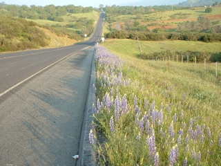
We started walking again about 6 p.m. After a short time we saw the first gray pine since Henry Coe Park. It was a sure sign that we were gaining altitude and now in the foothills. (Of course we could also tell that by how steep the road was.) We got to the Horseshoe Bend Recreational Area campground just as it was getting dark. We had walked a total of 13 miles on pavement, on roadsides, and we decided that next time we would try to do things differently. Since Muir took a ferry across the San Joaquin River and we had not yet used up our ferry ride, we would walk directly to the Barrett Cove Recreational Area where we would beg a boat ride from a ranger or fisherman or water skier to the Horseshoe Bend Recreational Area and thus avoid that whole stretch of road. The only thing we really would have missed that way would be the veritable ornamental garden of lupines, vetch, clover and little wildflowers that were planted along Highway 132 by some adopt-a-highway program benefactor.
designed by Julia van der Wyk © 2006